For pilots and aviation fans who ride

Fly your bike.

Pitot turns the phone on your handlebar into a heavy-jet flight deck. A speed tape that knows the road ahead, top of climb before the climb, riders as traffic, and callouts that sound like the real thing. No licence needed.

Pilots and aviation fansMade for anyone who looks up
Offline firstMaps, terrain and limits on your phone
iPhone, Apple Watch, AndroidEven an old phone on the bars
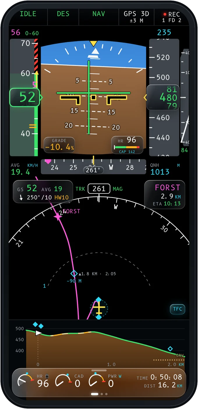
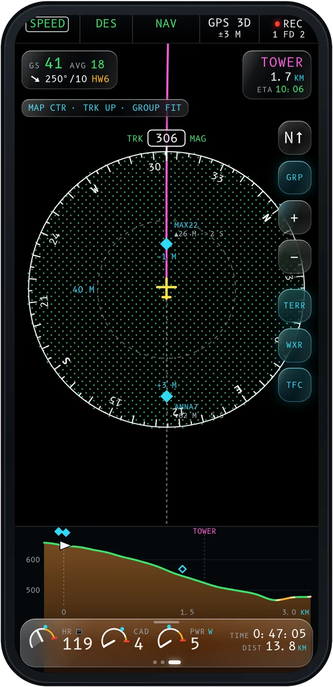
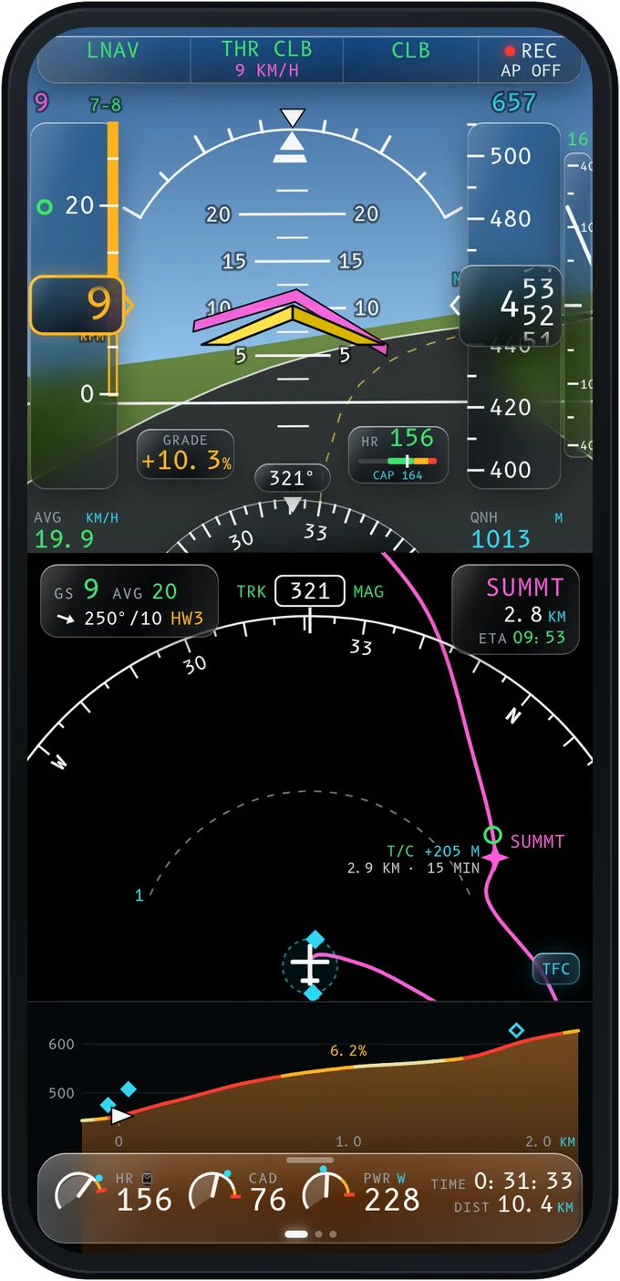
Pitot in the heavy-jet cockpit: speed and altitude tapes, attitude, the nav display and the profile ahead

Every instrument, rebuilt for the road

PFDPrimary flight display
NDNavigation display
VSDVertical situation
EICASRider systems
MCDURoutes and performance
ECLElectronic checklist
TCASRiders as traffic
7700Crash detection

Not a pilot? Even better.

You don't need a licence to fly heavy.

Pitot is for pilots, and just as much for aviation fans who ride. If you know a 777 by the sound of its engines, watch pushbacks from the gate window or fly the sim at night, this is your flight deck. Pick the heavy-jet cockpit and every ride is a flight, from preflight to block-in.

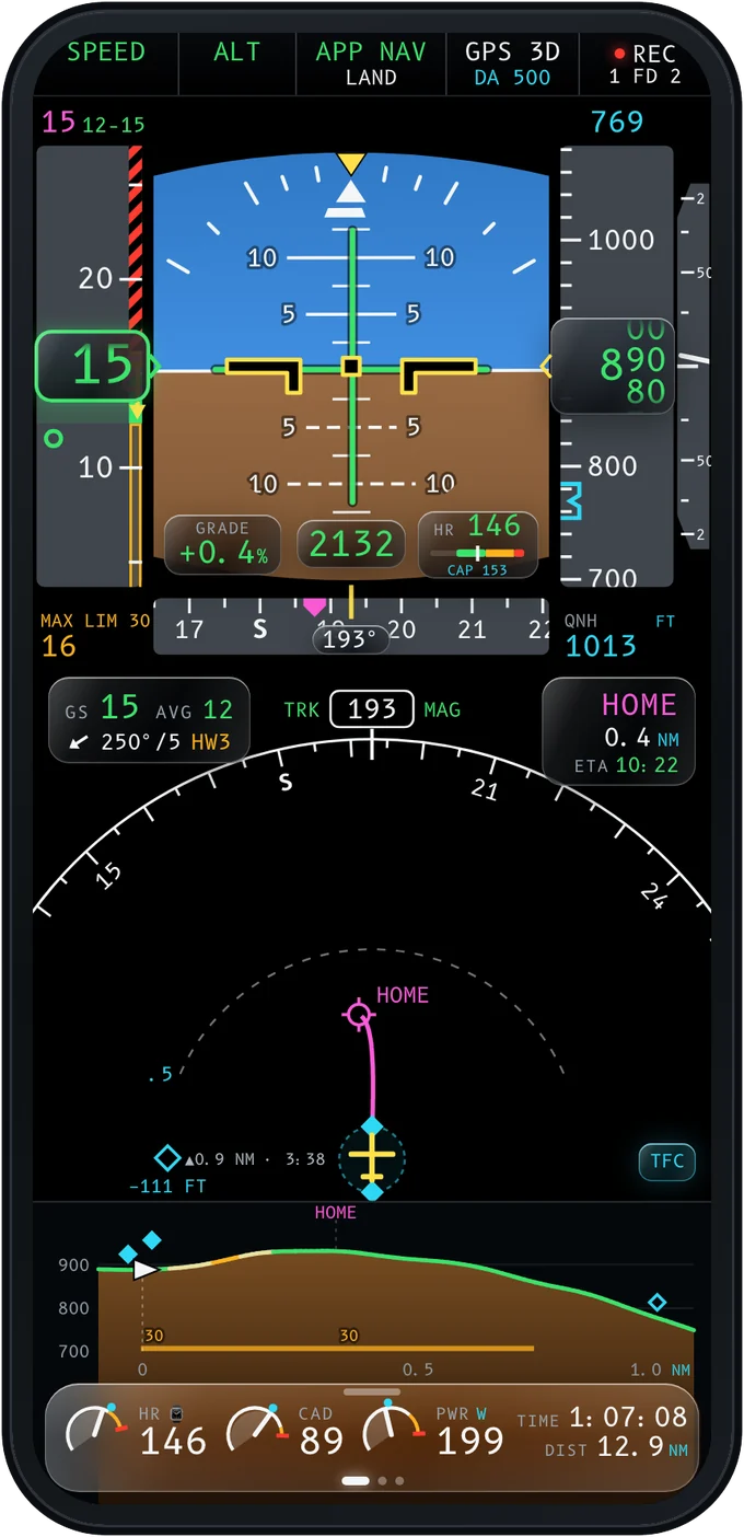
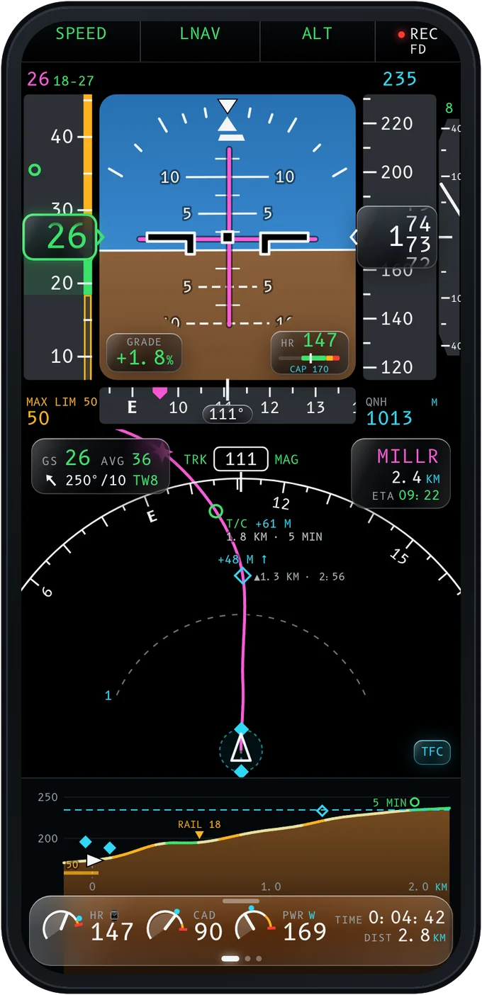
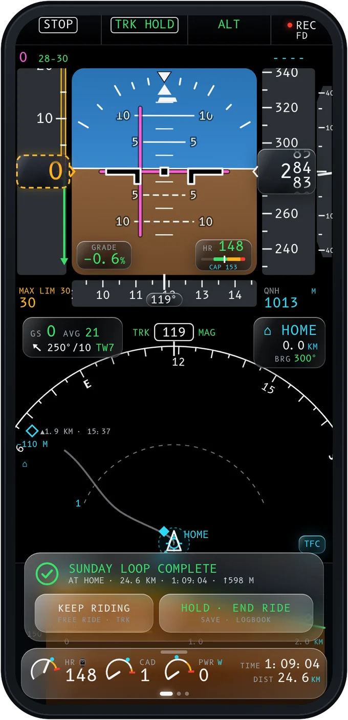
Heavy-jet cockpit at cruise: SPEED, LNAV, ALT in the mode strip and a group rider ahead as traffic Heavy-jet cockpit at home: route complete, keep riding or end the ride
  1. PREFLIGHTThe day brief: aircraft, fuel, wind and daylight on the MCDU.
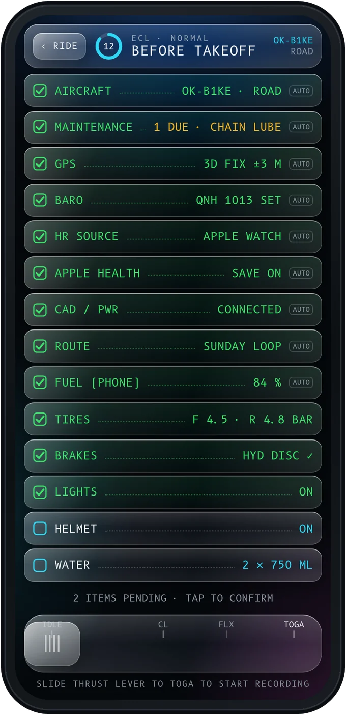
  2. BEFORE T/OA checklist that ticks itself.
  3. TOGASlide the thrust lever. The ride starts recording.
  4. THR CLBThe mode strip calls the climb; T/C says where it ends.
  5. SPEED · LNAVCruise on the flat, a buddy ahead as traffic.
  6. IDLE · DESCoasting down, the barber pole watching the corners.
  7. APPROACH“Minimums.” “Retard.” Home in sight.
  8. BLOCK INBlock time, a flight level, a logbook entry.

In flight

Everything you want to know about the road ahead, and more.

Pitot reads the route before you ride it: every curve, every gradient, the surface and the speed limits. Then it shows you, the way a cockpit would.

SPEED TAPE · ENVELOPE

The speed tape knows the road. Green is the pace for this gradient and wind. Amber means too slow, or too hard for your heart. The red barber pole is too fast for what comes next: it comes down to meet you before the hairpin does, with the reason written on the tape.

MAX ↲ 53 · HAIRPIN 10 M
Pitot primary flight display before a hairpin: the barber pole drops to 53 km/h
T/C · VSD

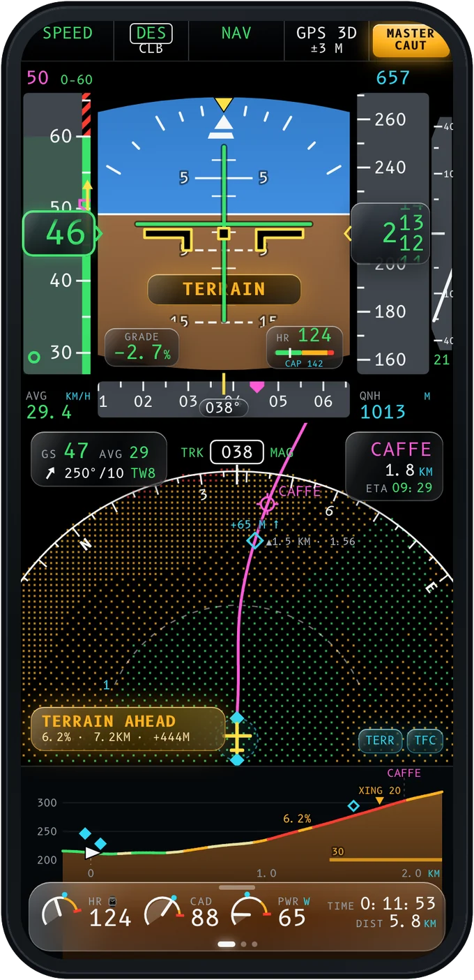
Top of climb, before the climb. Every climb on your route is marked on the map with what's left: metres, kilometres and minutes at your pace. The profile below shows the wall before you see it.

Terrain ahead: the map paints the climb amber and red
AURAL

Callouts from the flight deck. A master caution chime, then the callout, then the exact issue. Approach callouts count you home: one thousand, minimums, retard.

TCAS · TRANSPONDER

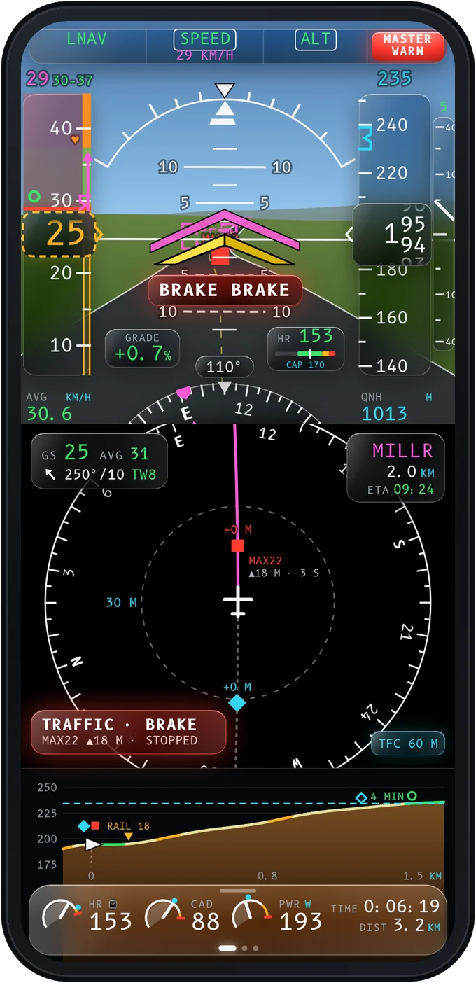
Traffic, traffic. Ride with friends and they show up as traffic, phone to phone over Bluetooth, even with no signal. When the rider ahead brakes hard, you hear BRAKE BRAKE.

A traffic resolution: rider MAX22 brakes 55 m ahead
EMERGENCY

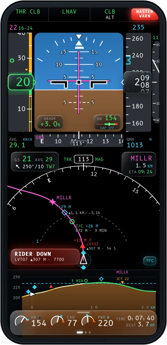
Rider down. Squawk 7700. After a hard impact and 20 seconds of stillness, Pitot counts down from 30. If you don't cancel it, your group sees 7700 and your emergency contact gets a text with your position.

Rider down: a 7700 squawk on the navigation display
OFFLINE

Made for the mountains, where there's no signal. Terrain, roads, speed limits and your routes live on the phone. Ride in airplane mode and nothing goes blank: the map, the profile and the speed tape keep working, and a caution tells you before you leave the downloaded area.
Track-up map with terrain and a centred own-ship symbol

Your type rating

Three flight decks. One meaning.

Pick the cockpit you know: GA glass, fly-by-wire or heavy jet. The shapes change; the colours mean the same in all three.

GA glass cockpit with synthetic visionGA GLASSSynthetic vision
Fly-by-wire cockpit on approach in pilot unitsFLY-BY-WIREOn approach, in kt and ft
Heavy jet cockpit at cruise with a group rider aheadHEAVY JETCruise, buddy ahead
The plan Engaged and good Yours to set Needs attention Needs it now

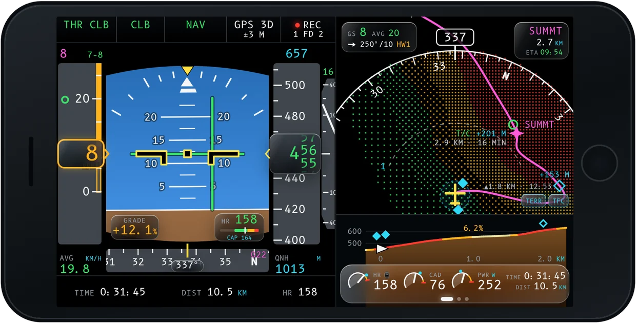
Turn it sideways for two displays.

In landscape, Pitot becomes a two-screen cockpit: the PFD on the left, the nav display and the dock on the right.

Landscape two-display cockpit

Preflight

Preflight, like a pilot.

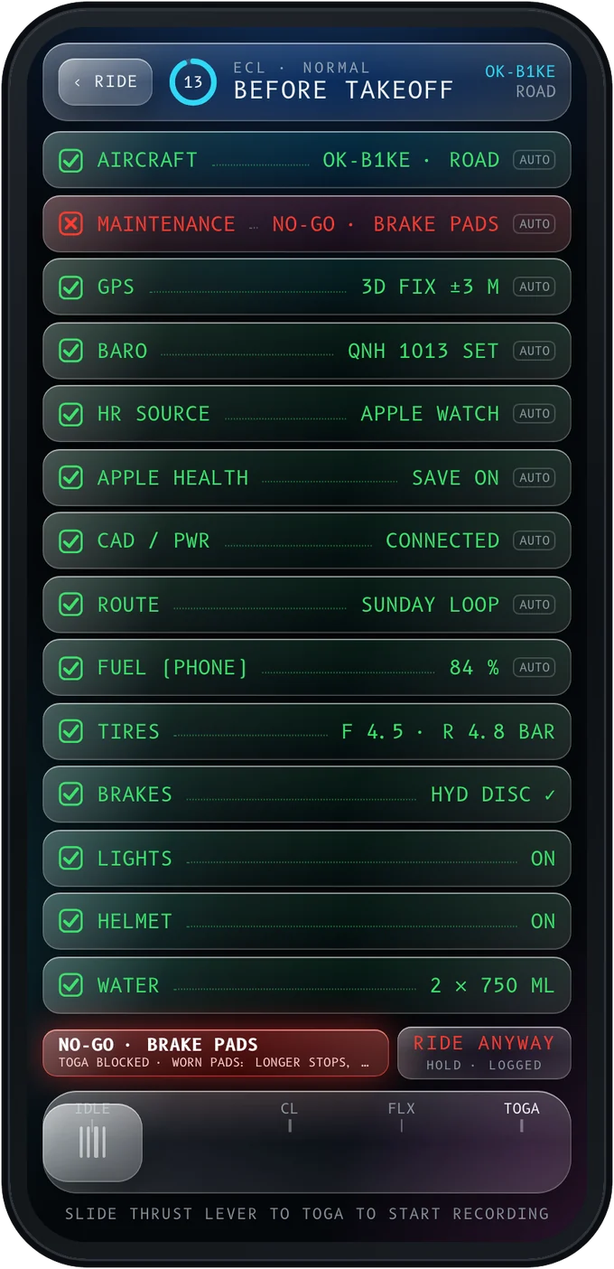
Every ride starts parked, on PREFLIGHT. Pitot checks what it can sense by itself, asks about the rest, and won't let you take off on brakes that are overdue.

ECL · TOGA

A checklist that checks itself. GPS, barometer, heart-rate source, Apple Health, sensors and the phone's own fuel tick themselves. Tyres and brakes come from your Hangar. Then slide the thrust lever to TOGA and the ride starts recording.

GPS · 3D fix ±3 mSensedAUTO
HR source · Apple WatchConnectedAUTO
Tires · F 4.5 · R 4.8 barFrom the HangarCHECKED
Before takeoff checklistChecklist with a NO-GO brake pads item blocking takeoff
TECH LOG

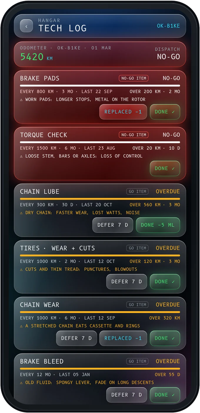
A tech log for every bike. Brake pads, chain, sealant and bleeds, due by kilometres or days. A NO-GO item past due blocks takeoff until you fix it, or log an override.

Tech log with maintenance tasks and NO-GO items
HANGAR

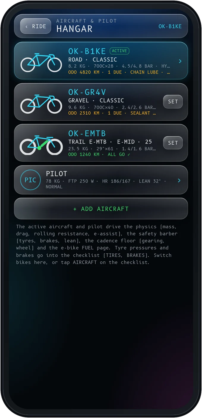
Every bike is an aircraft. Road, gravel and e-MTB, each with its own registration, weight, tyres and brakes. The physics, the limits and the suggested tyre pressures follow the bike you fly today.

Hangar with three bikes and a pilot profile

Routes

Plan anywhere. Fly it here.

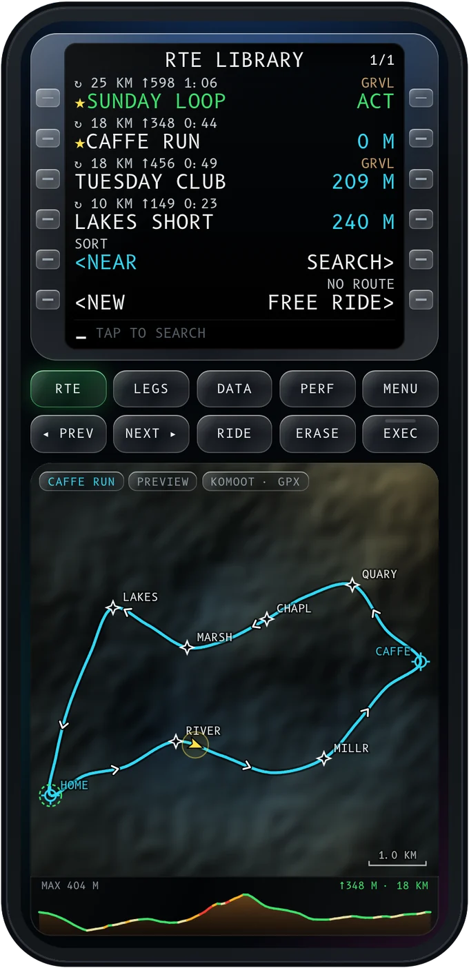
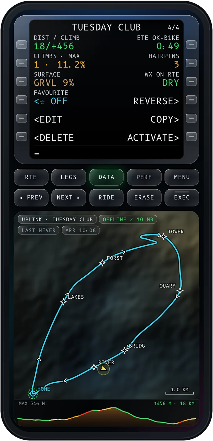
Build a route in the planner you already use and share the GPX or FIT to Pitot. Or draw it on the map, or ask for a round trip. Your routes live in an FMC-style library with the numbers that matter before you go.

KomootRide with GPSOsmAndBikemapGPX · FIT
JOIN AT NEARESTDIRECT TOROUND TRIP⌂ RTBFREE RIDE
Route library in the MCDU Route data before the ride

After landing

A logbook worth keeping.

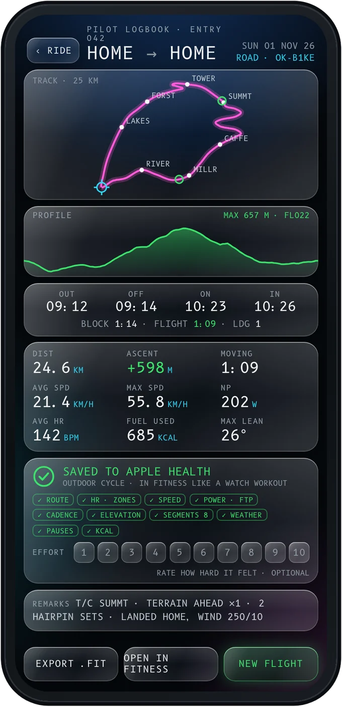
Every ride becomes a logbook entry: out, off, on and in times, your track, the profile with your highest point as a flight level, and a workout saved to Apple Health or Health Connect.

Max altitude FL 022 Highest point of the ride as a flight level: 657 m, about 2,200 ft.
Block timeHOME → HOME
1:14
OUT 09:12 · OFF 09:14
ON  10:23 · IN  10:26
Saved to Apple Health Outdoor
Cycle
RouteHR zonesPowerCadenceElevationWeatherSegments
LOGBOOK

The end of the ride, done right. A track that draws itself, counters that ease in, and a rating for how hard it felt. Export FIT, upload to Strava, or save the ride as a route.

Logbook entry after a ride
EICAS

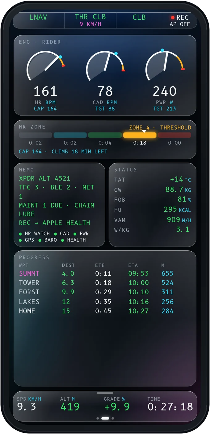
Your engines, on one page. Heart rate, cadence and power as dials with targets, time in each zone, phone and e-bike fuel, and a progress table with the ETA at every fix.

EICAS rider systems page

And everything else

For pilots and aviation fans who ride.

Apple Watch companion

Heart rate, the workout session and alerts as taps on your wrist.

Heart rate your way

From the Watch, a chest strap or AirPods Pro 3, with a cap that knows how long the climb is.

Pilot units

Knots, feet, nautical miles and fpm, or plain metric. Approach callouts follow your units.

Night mode

Dimmer glass after sunset and in tunnels. Alerts stay at full brightness.

Privacy zones

The transponder goes quiet around home and work, so nobody can trace where your rides start.

Free ride

No route? The instruments stay, with the road ahead and a HOME pointer on the compass.

Pitot app icon

Cleared for takeoff.

Pitot is in development for iPhone, Apple Watch and Android, with Wear OS to follow.

Coming to theApp StoreSOON Coming toGoogle PlaySOON

PITOT, RUNWAY 27, CLEARED FOR TAKEOFF. HAVE A GOOD RIDE.